One of the most impressive mountain peaks in Southern California is Mount San Jacinto. Located a short drive from the popular tourist destination of Palm Springs, the mountain offers sweeping views of the deserts and even the ocean on a clear day. So, if you are planning a visit, you might want to know, can you drive to the top of Mount San Jacinto?
You can’t reach the top of Mount San Jacinto by car, but you can drive up to about 5,500 feet. Visitors looking to reach the summit can then hike from a nearby trailhead. You also have the option to take the Palm Springs Aerial Tramway to around 8,500 feet and then continue hiking to the top.
Mount San Jacinto is a must-visit location for nature lovers visiting Southern California. This post will reveal the best ways to access the mountain, how to reach the summit, and conditions to consider during the winter months.
Mount San Jacinto – Can You Drive to the Top
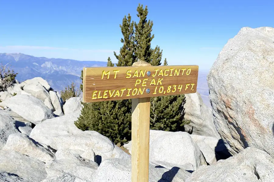
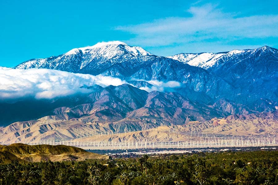
Mount San Jacinto (officially named San Jacinto Peak) is the highest point in Riverside County. The mountain, which towers 10,834 feet, is located just west of the City of Palm Springs. The mountain is a popular tourist destination and offers a great place to escape to the outdoors.
San Jacinto Peak is located within Mount San Jacinto State Park. The 14,000-acre park has over 50 miles of trails, including several drive-up and hike-in campsites. There are two main ways to access Mount San Jacinto — driving or the Palm Springs Aerial Tramway.
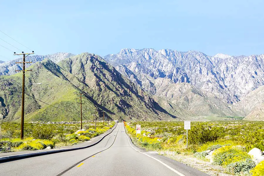
First, visitors can drive US Highway 243, which runs along the western base of the mountain. This option follows a well-paved, two-lane highway that reaches an elevation of about 5,500 feet (at the Marion Mountain Trailhead). The road connects from Banning (along US 10) and takes about 30 minutes (one way). The same drive will take about 1.5 hours from Palm Springs. An alternative to driving is taking the Palm Springs Aerial Tramway from Palm Springs (more on that below).
It’s important to note that neither option will take you all the way to the summit of the mountain. Reaching the summit will require a strenuous hike either way. From the Marion Mountain Trailhead, hikers will need to hike 5.6 miles (one way) to the summit climbing about 4,500 feet in elevation. This hike takes about 9-10 hours to complete.
US 243 is a well-paved road that is open to most types of vehicles. RVs are allowed on the road, but there isn’t parking for RVs at the trailhead. The only place to park is at a designated, reserved campsite. Most campsites have a restriction of 24 feet length for trailers and RVs. Cars should have no issue finding parking at the trailhead.
Since the drive up the backside of Mount San Jacinto doesn’t reach an extremely high elevation, the views can be limited. You will get excellent views of the valleys to the east, but the road hugs the mountain tightly, so you won’t get views of the summit.
The benefit to driving is better access to the hiking trails and campsites. However, if you are going for the views, most visitors agree that the Palm Springs Aerial Tramway views are far superior.
While road tripping through California, the drive up Mt. Lassen or Mt. Baldy is also worth mentioning. Though neither mountain offers a road that goes entirely to the top, the views are worth it.
Other Posts of Interest
- Can Anyone Drive On The Bonneville Salt Flats?
- What Is The Best Time Of Day To Drive Through Los Angeles?
- Does US Highway 50 Go Coast To Coast?
- Can You Drive All The Way Around Crater Lake?
Palm Springs Aerial Tramway – A Great Alternative to Driving
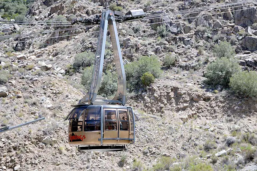
A popular alternative to driving along the base of Mount San Jacinto is taking the Palm Springs Aerial Tramway. The tram ride, which is the world’s largest rotating tramcar, takes passengers along a 2.5-mile route up the steep western face of the mountain. The trip takes a total of just 10 minutes each way, climbing to an impressive elevation of 8,500 feet. Visitors should come prepared with warm clothing as the temperature at the top can be 30 to 40 degrees cooler than in Palm Springs.
Road Trip Answers Fun Fact: Naturalist John Muir once wrote, “The view from San Jacinto is the most sublime spectacle to be found anywhere on this earth!”
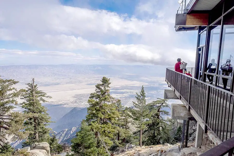
The top of the tramway connects to Mountain Station (which is not accessible by car). There, visitors will find two restaurants, observation decks, a natural history museum (with documentary theaters), and a gift shop. While Mountain Station isn’t at the top of the mountain, visitors can continue the hike to the top, which is 6 miles long and climbs an additional 2,300 feet.
There is a cost to ride the tramway, but the views are spectacular and well worth the price. Reservations can be made online, or you can purchase tickets at the tramway station.
Does it Snow on Mount San Jacinto?
While it does snow on Mount San Jacinto, the snow levels depend heavily on the amount of precipitation that Southern California receives. In dry years, the mountain might get a dusting of snow. However, wet years can produce several feet of snow that can last for several months.
The average snowfall for the year is approximately 119 inches. Snow can arrive as early as September, with the last snow occurring as late as May. However, the majority of all snowfall happens between November and March, with January being the snowiest month (coinciding with Southern California’s rainy season).
In any case, snow does not stick around all year. Snow rarely falls below 6,000-foot elevation meaning most roads remain clear and safe to drive throughout the winter. However, it’s advised to check road conditions just in case. During the winter, hikers are encouraged to bring microspikes as trails can be slippery and dangerous.
Is Mount San Jacinto a Volcano?
The State of California is one of the most tectonically active places in the United States. Consequently, much of the landscape has formed as a result of shifting tectonic plates and underlying volcanic activity.
The state is home to about 20 volcanoes, seven of which are considered still active. However, volcanic activity did not form Mount San Jacinto. Instead, the mountain was formed from pressures from the nearby San Jacinto fault, which pressed the mountain into its steep shape.
When is the Best Time to Visit Mount San Jacinto?
The best time to visit Mount San Jacinto is after Labor Day weekend, when the summer crowds have subsided. However, the temperatures will still be comfortable during the late summer and early fall, and camping permits will be easier to obtain.
However, if you don’t mind the crowds, the summer months are just as great.
Is the Palm Springs Tram Scary?
The Palm Springs Aerial Tramway can be unnerving for some passengers who have a fear of heights. Passengers have reported experiencing vertigo or ears popping from the rapid change in elevation. The tram is supported by five towers along the route. Each car may sway a little as they pass over the towers.
Despite this, the Palm Springs Aerial Tramway is well-engineered and extremely safe. The tram cars are attached to a 40mm wide cable (which is about five times the diameter of a standard elevator cable). The tramway is also regularly inspected for safety.
Reaching the Summit of Mount San Jacinto
It’s clear that the best way to reach the summit (or a close elevation) is to take the Palm Springs Aerial Tramway. The only downside to the ride is the cost, especially if you are traveling with a large group or on a budget. The road along the backside of Mount San Jacinto is a perfect alternative to access the many trails and campsites within the park.